
Center for Epidemiology and Animal Health
The Center for Epidemiology and Animal Health (CEAH) is a world-renowned science center within APHIS Veterinary Services.
Latest Products
Download the second interim report (June 2023).
Download (4.35 MB)
The Outbreak Surveillance Toolbox is designed to provide veterinary epidemiologists with resources for designing surveillance schemes to support outbreak response.
Resources
About CEAH
This report gives a comprehensive overview of CEAH's impact on safeguarding animal health in the United States for fiscal year 2024.
Download (5.32 MB)
CEAH is located within APHIS Veterinary Services' (VS) Strategy and Policy (S&P) division. Our mission is to provide applied and innovative analyses to generate science-based information and solutions for decision making around complex national animal health issues.
We support key monitoring and surveillance programs across the United States and serve as the focal point for disease reporting to the World Organisation for Animal Health (WOAH). We are also a collaborating center for surveillance, risk assessment, and epidemiologic modeling with WOAH. In this role, we interact with collaborating centers domestically and internationally and participate in standards setting, analytical, and training activities.
Staffed with a multidisciplinary team, CEAH provides scientifically sound and statistically valid information and tools to help policymakers reach critical decisions regarding animal health issues. Our team includes:
- Epidemiologists and veterinarians
- Spatial analysts and geographic information specialists
- Economists and statisticians
- Information and computer specialists
- Biologists and entomologists
- Librarians and technical writers
- Administrative support

CEAH is made up of the following units:
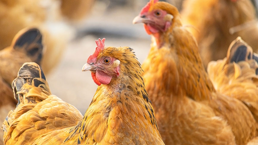
- National Animal Health Monitoring System (NAHMS)—NAHMS is the statistical unit within APHIS Veterinary Services responsible for population estimates related to animal health management and productivity. NAHMS conducts national studies on the health and health management of livestock, equine, aquaculture, and poultry populations within the United States at regular intervals.
- Program Coordination and Implementation (PCI)—PCI strengthens CEAH’s mission by supporting staff with communications and editing support, project management, operations and logistics support, and Confidential Information Protection and Statistical Efficiency Act (CIPSEA) and Paperwork Reduction Act (PRA) compliance.
- Geospatial Analytics, Products, and Services (GAPS)—GAPS provides map-centric products and solutions, as well as geospatial analyses that support emergency planning and response, disease risk analyses, epidemiology investigations, disease monitoring and reporting, and the overall mitigation and prevention of animal disease introduction and spread in the United States.
- Surveillance Design and Analysis (SDA)—Through collaborative surveillance design, analysis, evaluation, and communication, SDA develops and enhances animal disease surveillance. SDA provides practical and timely surveillance solutions to meet customer needs, from single-premises sampling plans to robust national-level surveillance systems, including the proposed National List of Reportable Animal Diseases. SDA also serves as the WOAH Focal Point for U.S. animal disease reporting.
- Transboundary Disease Analytics (TDA)—TDA identifies and characterizes global animal health hazards, assesses hazards and strategies to prevent the entry of transboundary diseases into the United States, conducts pathways assessments, and contributes to animal disease preparedness and response planning, implementation, and evaluations.
- Domestic Animal Health Analytics (DAHA)—DAHA supports domestic disease programs through risk analysis, epidemiologic evaluations, and providing indemnity and compensation analyses and tools.
- Animal health reporting
- Antimicrobial resistance surveillance and monitoring
- Comprehensive and integrated surveillance plans, evaluations, analytics, and reports
- Data management, analytical support, and interactive visualization
- Disease case definitions
- Economic analysis
- Emerging animal disease response, cost analysis, and support
- Epidemiologic investigations and economic modeling
- Foreign animal disease (FAD) deployment
- Geospatial and mapping services
- Indemnity estimates
- Livestock-wildlife interface study/analysis
- National and targeted animal studies
- WOAH Collaborating Center activities
- Ongoing animal health monitoring
- Outbreak surveillance and epidemiologic support
- Risk assessment and risk identification
- Syndromic surveillance
- Training and outreach
CEAH actively participates in various international and domestic scientific working groups, committees, and training.
CEAH is a WOAH collaborating center for animal disease surveillance, risk analysis, and epidemiological modeling. We partner with WOAH and member countries to improve international disease surveillance capabilities and analytic methods supporting trade decisions through information sharing, risk identification, risk analyses, and surveillance activities.
- Allen D. Leman Swine Conference
- American Association of Avian Pathologists Annual Meeting
- American Association of Bovine Practitioners
- American Association of Swine Veterinarians
- American Association of Veterinary Laboratory Diagnosticians
- American Dairy Science Association
- American Sheep Industry and American Goat Federation
- American Veterinary Medical Association
- APHIS National Feral Swine Damage Management Program Steering Committee
- APHIS GIS Steering Committee
- Biological Indications and Warning Analytic Community
- Brucellosis Research Meeting
- Center for Plain Language
- Center of Excellence for Emerging and Zoonotic Animal Diseases
- Colorado Veterinary Medical Association
- Council of Science Editors
- ESRI International and Federal User Groups
- Federal Communicators Network
- Federal Interagency Committee on Invasive Terrestrial Animals and Diseases (animal pathogens subcommittee)
- Federal Tick-Borne Disease Integrated Pest Management Workgroup
- Foreign Animal Disease Threat Subcommittee
- Interagency Steering Committee for Avian Influenza Surveillance in Wild Migratory Birds
- International Conference on Animal Health Surveillance
- International Pig Veterinary Society Congress
- International Poultry Expo
- International Society for Veterinary Epidemiology and Economics
- Live Bird Market Working Group
- National Association of Government Communicators
- National Biosurveillance Integration Center
- National Bison Association
- National Cattlemen’s Beef Association
- National Dairy Herd Improvement Association
- National Institute for Animal Agriculture
- National Mastitis Council
- National Pork Board’s Swine Health Committee
- National Poultry Improvement Plan
- WOAH/FAO Network of Expertise on Animal Influenza
- Plain Language Association International
- Secure Broiler Supply, Secure Turkey Supply, Secure Egg Supply Workgroups
- Society for Risk Analysis Annual Meeting
- Society for Technical Communicators
- Society of Vector Ecology
- Toastmasters Resource Masters
- United States Animal Health Association
- VS Mobile Information Management Network
- World Buiatrics Congress
- World Dairy Expo
- World-Wide Human Geography Data Working Group
Contact Us
Center for Epidemiology and Animal Health
Email: vs.ceah@usda.gov